Total Control at your Fingertips
High Performance Technology
Beyond Your Expectations

Features
-
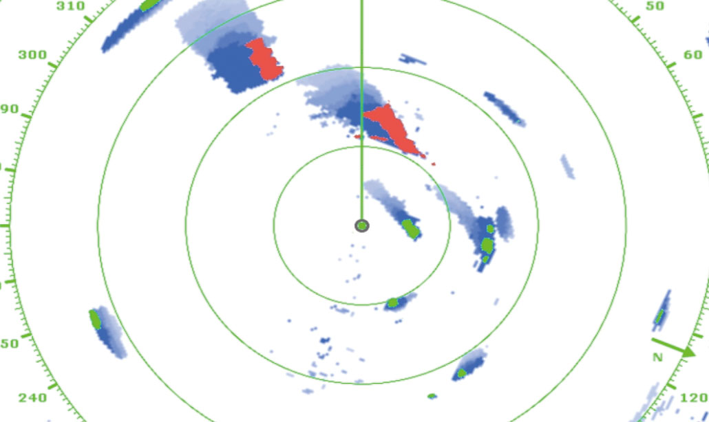
Target Analyzer™ function utilizing Doppler technology spots hazardous targets instantly with DRS4D-NXT
The DRS4D-NXT Solid-State Doppler Radar is the first Radar in the world to use the new FURUNO exclusive Target Analyzer™ function. Targets that are approaching your vessel automatically change color to help you identify when they are hazardous. Green echoes are targets that stay stationary, or are moving away from you, while red echoes are hazardous targets that are moving towards your vessel.Hazardous targets are displayed in bright red
-
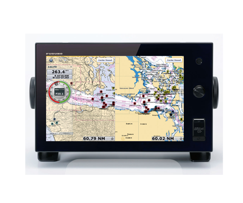
The marine industry's first multi touch screen MFD
-
Easy, intuitive and slick operation with touch screen and RotoKey
-
Seamless, instant chart/radar redraw with TimeZero Technology
-
Detailed 3D and 2D charts and high resolution satellite images
-
Luxury, piano black wide screen coated with glass panel
-
Simple, flat display with minimum mechanical keys
-
Wireless LAN connectivity for weather information and automatic chart unlocking
-
NavNet Remote and NavNet Viewer apps for iOS and Android devices
-
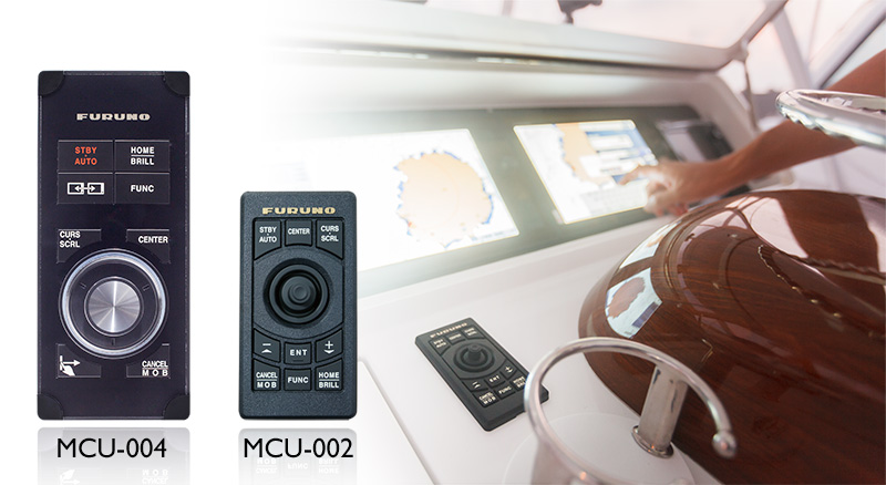
Remote Control Unit MCU-004 and MCU-002
The new MCU-004* features a rotary knob as well as a fully articulated joystick for smooth and simple operation, even in heavy seas. Take full control over your NavNet TZtouch, switch active display and much more, with the push of a button.
*Coming soon.MCU-002 is a compact, waterproof and with a small footprint that is easy to install and operate anywhere on your vessel. The Remote Control Unit works as a supplement to the multi touch operation of NavNet TZtouch.

Specifications
DISPLAY
| Display Unit | 14.1" wide Color TFT multi touch LCD |
|---|---|
| Screen Brightness | 900 cd/㎡ |
| Screen Resolution | WXGA 1280 x 800 pixels |
| Language | English (US & UK), French, Spanish, German, Italian, Portuguese, Swedish, Danish, Norwegian, Finnish, Greek, Chinese (simplified Chinese characters), Japanese |
PLOTTER
| Position Accuracy | GPS: 10 m, MSAS: 7 m, WAAS: 3 m |
|---|---|
| Chart | MapMedia mm3d chart (Jeppesen/Navionics/NOAA) |
| Memory Capacity | 30,000 user points, 30,000 points for ship's tracks, 200 planned routes (500 points per route) |
RADAR
| Display Mode | Head-up, North-up*
*Heading input required. |
|---|---|
| Echo Trail | Interval: 15 s, 30 s, 1 min, 3 mins, 6 mins, 15 mins, 30 mins and continuous |
| Target Tracking | Max 100 Targets* *Heading input required. |
OTHERS
| AIS | Up to 100 targets |
|---|
INTERFACE
| CAN bus | 1 Port |
|---|---|
| LAN | 3 Port (100 BASE-TX) |
| USB Port | 1 Port (USB2.0) |
| Video Output | 1 Port (DVI-D) |
| Video Input | 2 Ports (NTSC/PAL) |
| SD Card Slot | 2 Slots (SDXC card - supports up to 128GB) |
| Waterproofing | IP56 (with connector cover), IP22 (with connector boot) |
| Power Supply | 12-24 VDC, 60 W (5.0 - 2.5 A) |
| Size | Tabletop mount: 273 (H) x 428 (W) x 150 (D) Flush mount: 245 (H) x 395 (W) x 130 (D) |
| Weight | Tabletop mount: 8.0 kg Flush mount: 7.1 kg |
Reviews
There are yet no reviews for this product.
